
The Bloustein School is pleased to announce a display of 18 historic maps of New Jersey and other U.S. cities in the lobby of the Civic Square Building. These pieces were donated to the Bloustein School; two pieces valued at $3,600 were donated by Dr. Mladen “Mike” Solar and the remaining sixteen pieces, valued at $40,600, were donated by Mr. Orrin Lippoff.
Mr. W. Graham Arader, founder and owner of Arader Galleries in New York City, facilitated the donation of the maps. Professor Ray Caprio, director of the Bloustein School’s undergraduate programs, was also instrumental in making the donation possible.
“The set of maps represents a variety of cartographic styles produced during the 19th century, and presents a fine viewing opportunity for our many students, faculty, and visiting scholars interested in urban planning and the art of map making,” said Bloustein School Dean James W. Hughes.
The antiquarian maps are already “having a positive impact on the learning environment of the school,” Dean Hughes noted. Students have noted that the maps add a museum effect to the school while adding buzz and visual interest to the many receptions held in the school’s lobby. Additionally, a student commented, “This is what we do in planning and public policy—transportation planning, greening of cities, cities designed to promote healthy outcomes. Also, we love train stations!”
The maps are displayed in the main lobby of the Civic Square Building, 33 Livingston Avenue, New Brunswick, NJ. The lobby is open to the public during normal business operating hours, Monday through Friday, 8:30 a.m.-5:30 p.m.
Listing of Donated Maps in Civic Square Building Lobby
NJ-001. Map of New Jersey, Crowell Publishing Company
The Twentieth Century Peerless Atlas and Pictorial Gazetteer of All Lands.
Chromolithographed map, 13 3/8 x 10 5/8 inches, 1906 (Orrin Lippoff)
NJ-068. Newark to Paterson – East, Julius Bien & Co.
Atlas of the Metropolitan District and adjacent country comprising the counties of New York, Kings, Richmond, Westchester and part of Queens in the state of New York, the county of Hudson and parts of the counties of Bergen, Passaic, Essex and Union in the state of New Jersey.
Chromolithographed map, 34 ½ x 23 inches, 1891 (Orrin Lippoff)
NJ-076. Map of Asbury Park Monmouth County New Jersey, Woolman & Rose
Historical and Biographical Atlas of the New Jersey Coast.
Lithographed map with hand color in full, 13 ¾ x 23 ½ inches, 1878 (Orrin Lippoff)
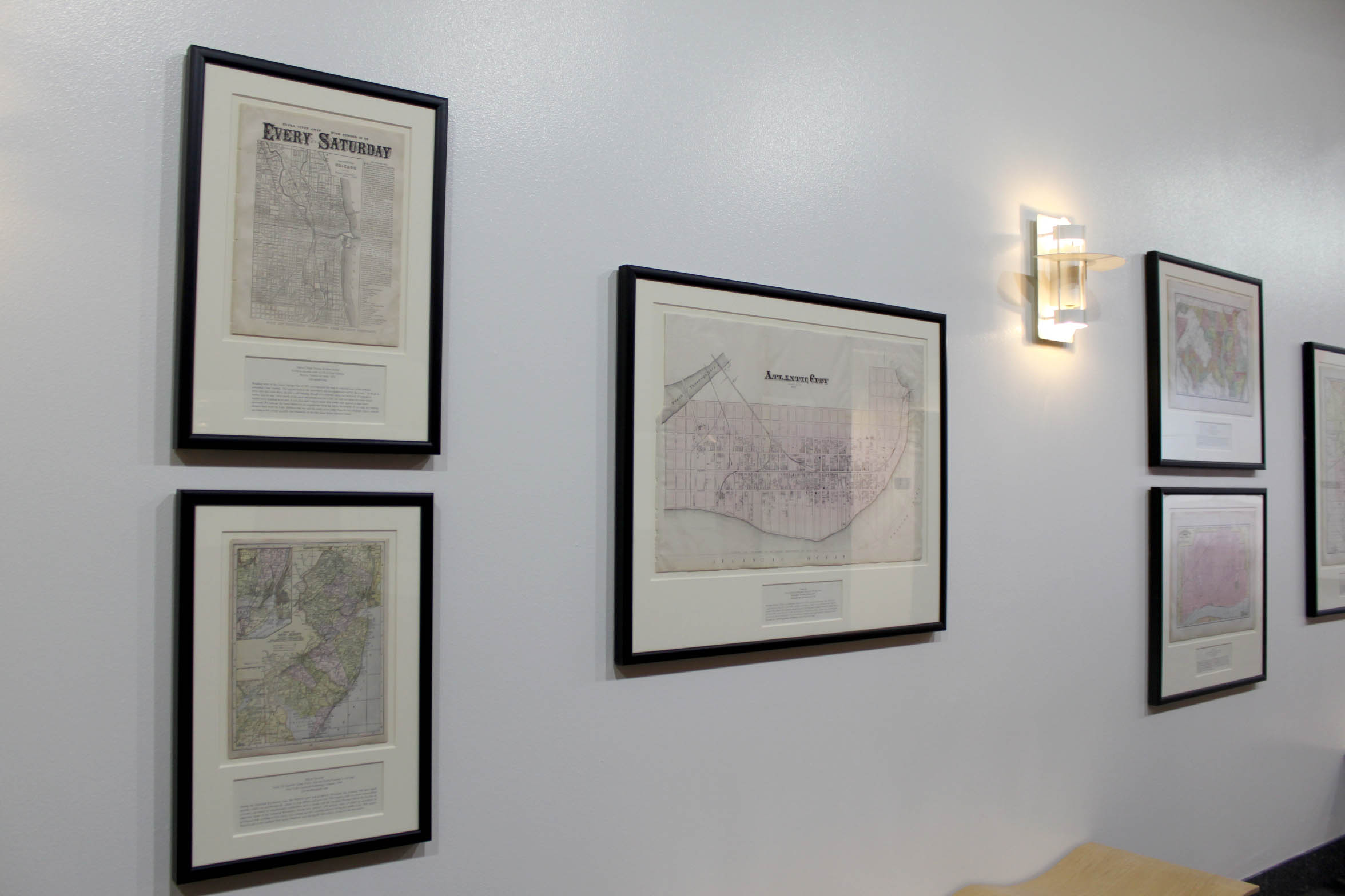
NJ-080. Atlantic City, Woolman & Rose
Historical and Biographical Atlas of the New Jersey Coast.
Lithographed map with hand color in full, 20 ¼ x 31 inches, 1878 (Orrin Lippoff)
URB-001. Boston, J. & F. Tallis
The Illustrated Atlas, and Modern History of the World: Geographical, Political, Commercial, and Statistical.
Lithographed map, 10 ½ x 15 inches, c. 1851 (Orrin Lippoff)
URB-002. Plan of Baltimore,S. Augustus Mitchell, Jr.
Mitchell’s New General Atlas.
Lithographed map with hand color in part, 12 ½ x 15 ¼ inches, 1869 (Orrin Lippoff)
URB-003. Maryland and D.C., Rand, McNally & Company
Rand McNally & Co.’s Indexed Atlas of the World.
Chromolithographed map, 15 ½ x 22 inches, 1892 (Orrin Lippoff)
URB-004. City of Washington, Samuel Augustus Mitchell
A New Universal Atlas Containing Maps of the various Empires, Kingdoms, States and Republics of the World.
Lithographed map with hand color in full, 14 x 17 ¼ inches, 1856 (Orrin Lippoff)
URB-006. Map of Chicago Showing the Burnt District, Ticknor & Fields
Issued as an extra with no.95 of Every Saturday.
Lithographed map, 14 ½ x 11 inches, 1871 (Orrin Lippoff)
URB-007. San Francisco, Rand, McNally & Co.
The New Business Atlas.
Chromolithographed map, 20 ¼ x 27 ½ inches, 1898 (Mike Solar)
URB-008. Railway Terminal Map of Chicago, Rand, McNally & Co. ”
Rand McNally & Co.’s Indexed Atlas of the World.
Chromolithographed map, 29 ¼ x 22 inches, 1892 (Mike Solar)
URB-009. City of New-York, Thomas Cowperthwait & Co.
The New Universal Atlas.
Engraved map with hand color in full, 16 ¾ x 13 ¾ inches, 1850 (Orrin Lippoff)
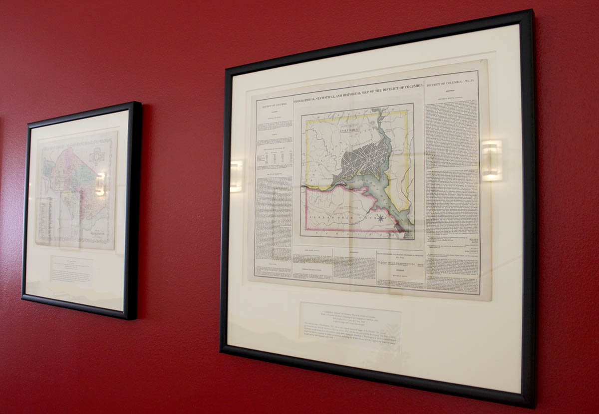
URB-011. Geographical, Statistical, and Historical Map of the District of Columbia, H.C. Carey & I. Lea
A Complete Historical, Chronological, and Geographical American Atlas.
Engraved map with hand color in part, 17 ½ x 22 inches, 1822 (Orrin Lippoff)
URB-014. Map of Detroit, Rand, McNally & Co.
Rand, McNally & Co.’s Indexed Atlas of the World.
Chromolithographed map, 15 5/8 x 22 inches, c. 1892 (Orrin Lippoff)
URB-015. Johnson’s Georgetown and the city of Washington, the Capital of the United States of America, A. J. Johnson
Johnson’s New Illustrated Family Atlas.
Lithographed map with hand color in full, 14 ½ x 18 inches, 1867 (Orrin Lippoff)
URB-016. Plan of Philadelphia, S. Augustus Mitchell, Jr.
Mitchell’s New General Atlas.
Lithographed map with hand color in full, 12 ½ x 15 ¼ inches, 1862 (Orrin Lippoff)
URB-017. Map of New Orleans, Rand, McNally & Co
Rand, McNally & Co.’s New Standard Atlas of the World.
Chromolithographed map, 21 ¾ x 15 ½ inches, 1898 (Orrin Lippoff)
URB-018. Cincinnati and Environs, Rand, McNally & Co.
Rand, McNally & Co.’s Enlarged Business Atlas and Shippers’ Guide.
Chromolithographed map, 27 ¼ x 20 3/8 inches, 1899 (Orrin Lippoff)